I ngā rā o mua, in days gone by, the loop of the Opawaho river that is now Beckenham was marshy land, covered in raupo, tussock and grasses. Waitaha people would have known the area first, and then came Kati Mamoe and, later, Kai Tahu.
Opawaho has been translated as "the outer, or seaward, pa" or "outpost". A Kai Tahu village or outpost settlement was built near where the Opawa Railway Station now stands, and the river become known as the stream of the outer pa or outpost.
The area was an important mahinga kaia source of plentiful food, especially tuere (blind eel) and kanakana (lamprey). The Opawaho was also part of a much used route from the Estuary through to Waihora/Lake Ellesmere for people from other nearby kainga. A track, called Pohoareare after an Opawaho chief, led from Opawaho over the sandhills around Ihutai/Bromley to the New Brighton area.
When pakeha came to the area, they called the river Heathcote. Captain Joseph Thomas, the Canterbury Association’s surveyor, named it after Sir William Heathcote, who was a committee member of the Association in England.
Fisherton and Beckenham Farm
In the early days of pakeha settlement, areas close to town like Addington and Sydenham grew quickly and outlying districts such as Beckenham were farmland, with just a few people owning big properties. The Fisher brothers, who came to New Zealand from Kent in 1850 on the Charlotte Jane, each owned half of present day Beckenham.
James and Harriet Fisher were given Rural Section 21 as a wedding present by Harriet’s father. This was a 100 acre (40.5 hectares) block covering all of the loop south of today’s Sandwich Road. It was known as the Fisher Estate. Later the district was called Fisherton.
James and Harriet drained the rich repo raupo swamplands and grew wheat. They later turned to dairy farming.
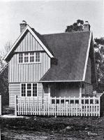
About 1880 they had a substantial wooden two-storey house built. It stood where 2/4 Malcolm Avenue is today, and was demolished in 1989.
Stephen Temple Fisher bought the 100 acre block (Rural Section 49) north of his brother James' property. It stretched from where Sandwich Road is today up to present day Tennyson Street. He called the property Beckenham Farm, after the English town the brothers came from, now part of London. Interestingly, the London suburbs of Sydenham, Beckenham and Bromley are close together, just as they are in Christchurch.
Stephen and Anne Elizabeth Fisher had five children and farmed their Beckenham property in the 1870s. Their large two-storeyed home was where St Peter's Church stands today in Fisher Avenue.
Streets are formed
Stephen Fisher died in 1897 and his land was bought by Richard May Morten, who owned a great deal of land in Christchurch. The land was subdivided and streets began to be formed.
Colombo Road (now Colombo Street) had been formed in 1878 and Tennyson Street was also an early street (1895). Beckenham and Norwood Streets followed in 1902, and Fishers Street (now Fisher Avenue) and Sandwich Road in 1903.
At about this time trams were being introduced to Christchurch, and this is part of the reason that Beckenham developed when it did. Trams made an enormous difference to people, enabling them to live further out from the city and still travel in and out quite easily. "Tramway suburbs" like Beckenham developed quickly. The trams came down Colombo Road to Devon Street in 1880. Later they ran as far as Tennyson Street and, in 1898, the line was extended to the foot of the hills. In 1906, over 200 people lived in Beckenham. Many of these worked in the city, using the trams as transport.
At the time that all this subdividing and building was going on, Beckenham was administered by the Heathcote Road Board. However, many of the new residents felt they would rather be part of Christchurch, and in 1907 Beckenham joined Christchurch city.
In 1906 James Fisher’s Estate was subdivided as Fisherton and a few years later in 1912, Martin, Malcolm and Corson Avenues were formed. The land south of Corson Avenue was known for a while as Riverview Estate and used for small holdings and market gardens, so the area still retained a semi-rural appearance.
About 1907, the Government built houses for working people, such as railway workers, in Longfellow and Seddon Streets. This was known as the Camelot Settlement and was one of the earliest examples of state housing. Unfortunately, because the rents were high (9 shillings a week, nearly a sixth of a worker’s weekly wage), the scheme did not succeed.
Beckenham in the 20th century
Gradually Beckenham developed to become the residential suburb it is today. In 1912 electricity was laid on. Sewerage and drainage systems were connected about ten years later. Before this, people had backyard toilet sheds called dunnies. There was a seat with a hole in it placed over a can. When it was dark, the night soil man would call and take away the contents of the can.
In the depression of the 1920s and 1930s jobs and money were scarce, but families had large gardens and hens to supply vegetables, fruit and eggs. Roads were gravelled rather than asphalted until the 1930s: very dusty when the nor-wester blew. The river was a popular playground for children, along its banks or on home-made rafts constructed out of old petrol drums and spare timber. The river often flooded on to roads and people’s properties, and this problem was only fixed in the 1970s.
The trams which had helped Beckenham grow were phased out in 1954, as buses took their place.
Schools
In Beckenham’s early days, children walked to Sydenham, Waltham or Somerfield schools, or attended a private school run by the Misses Palmer at 13 Tennyson Street. Beckenham School in Sandwich Road opened in 1915 with three classrooms, 149 pupils and four staff. By 1928 there were 562 pupils. The old building was pulled down in 1980 and replaced with the present one. St Peter’s Catholic School opened in 1927, in the old Fisher homestead and gradually acquired more modern buildings.
Streets
After the 1930s subdivision slowed down, but some recently formed streets are Redbridge Lane (1970), Karen and Ikamatua Lanes (1976), Tuscany Place (1987) and Castle Way (1991).
For more information about Christchurch street and place names, see Place Names.
Sources
- Cowan, James Māori folk tales of the Port Hills, Whitcombe & Tombs, 1923
- Taylor, W.A. Lore and history of the South Island Māori, 1952
- Beckenham, a suburb of Christchurch, New Zealand. Beckenham Neighbourhood Association, 1993
- The Estuary: where our rivers meet the sea. Parks Unit, Christchurch City Council, 1992
- Watson, James Along the hills, Heathcote County Council, 1989
