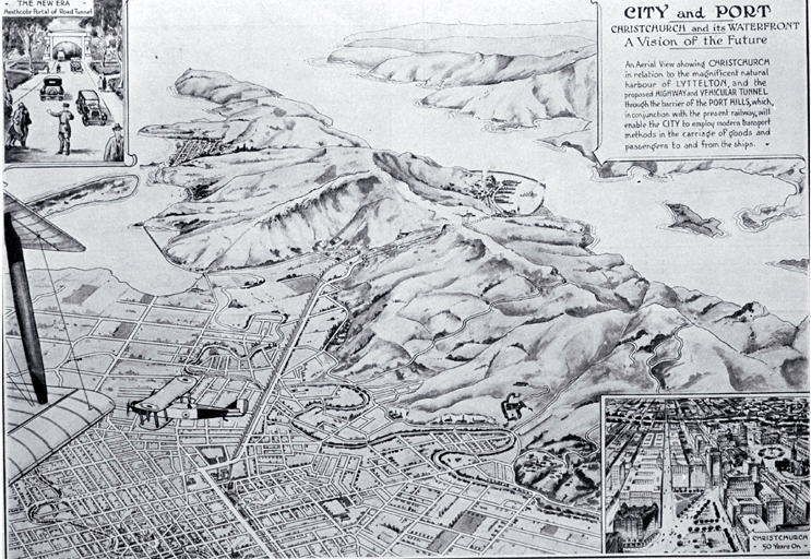
"An aerial view showing Christchurch in relation to the magnificent natural harbour of Lyttelton, and the proposed highway and vehicular tunnel through the barrier of the Port Hills which, in conjunction with the present railway, will enable the city to employ modern transport methods in the carriage of goods and passengers to and from the ships."
Date: c.1926
Although a rail tunnel linking Lyttelton to Christchurch had been in existence since 1867, it wasn't until 1956 that legislation was passed allowing for the construction of the Lyttelton Road Tunnel. Construction began in 1962 and was completed in 1964, opening on 27 February.
Do you have any photographs of the Lyttelton Road Tunnel? If so, feel free to contribute to our collection.
Kete Christchurch is a collection of photographs and stories about Christchurch and Canterbury, past and present. Anyone can join and contribute.
- Visit Kete Christchurch
- View more Picturing Canterbury posts
Map Of A Scheme Suggested By The Port And City Committee Showing A New Road Tunnel To Lyttelton


Add a comment to: Map of a scheme suggested by the Port and City Committee showing a new road tunnel to Lyttelton: Picturing Canterbury