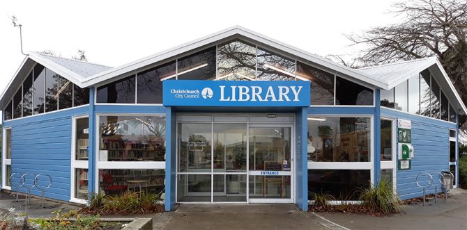
Kat investigates the history of the area where Redwood Library now sits.
Redwood and the Styx
I have recently been working at Redwood Library and it is a great hub for a lovely community. The library and the attached daycare centre have been serving the area since 1968, but, I wondered, what had been there before? The library is near what is now known as the Styx River and the area only really became known as Redwood when that facility opened.
In pre-colonial times, the wider Styx area was an important food production area for local iwi. To find out more check out Te Kōuka Whenua and Ka Huru Manu.
Sections everywhere!
Of course once European colonisation began and Kemp's Purchase was made, this area was administered by the Canterbury Association, who started selling the land in sections - town sections inside what are now the Four Avenues and rural sections outside of them. You can find a good overview of this process in Rural Sections, Town Sections and Town Reserves by Richard Greenaway.
Often research is started by going back in time from what is known to the unknown. However, with section maps, section documentation (page 280 corresponds to section 280 in this document from Archives New Zealand), Google maps, and such a distinct moment in time, it's possible to go forward in time from 1852 when the section upon which Redwood library now stands was first sold.
Section 280
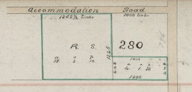
The section in question is Rural Section 280 and it was first purchased by Samuel Bealey, a very prominent early Christchurch citizen after whom Bealey Avenue and other landmarks are named. He owned many sections and made a lot of money from his land investments. It is likely that section 280 was farmed - as it was for many subsequent years. In 1863 the land changed hands and was bought by a McLean. Unfortunately the section documentation was not big on first names or even initials of purchasers and there were a lot of McLeans about in those days. However, after some head-scratching, I am pretty sure the purchaser was a Captain John McLean (not to be confused with the several other John MacLeans recorded in the MacDonald Dictionary of Early Canterbury Settlers). He soon subdivided the section - the shapes of which can still be seen in the land today. Accommodation Road, as shown in the below image, became Craddocks Road and finally Sturrocks Road.
Subdivision and George Craw
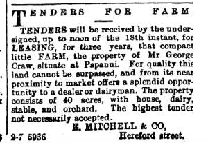
Moving to the subdivisions of rural sections register (images 409 - 411) we can see that the land was split into areas 818-820. Area 818 was bought by George Craw, 819 by Mr Barnard and 820 by William Tombs (Barnes Road was originally known as Tombs Road). Additionally in 1871 part of 820 was sold to the Crown to accommodate the railway line. 818 is where Redwood Library is now so that's the area I've mainly looked into. It was owned by George Craw (with a bit of mortgaging and reconveyancing which I haven't quite got my head around) until around 1900 by which time the Craw family had relocated to Little Akaloa. George had passed away in 1890 aged 57. Apparently the area was good farmland:
Into Modern Times
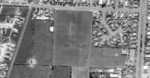
The trail goes a little cold from here for a few years as the information recorded in subdivisions register stops being updated in the early 1900s. Aerial photography indicates farming was still happening, with various farm houses also being built. Areas 819 and 820 become housing subdivisions - the former around 1975 and the latter around 1966 (I crossreferenced some street names on our street name index to see when they were first recorded). And the Sturrocks Road reserve became Redwood Park in 1967, to tie in with the upcoming community centre. From 1968 our extensive Library150 archive takes up the story of Redwood Library.
I've certainly enjoyed digging into the history of this area of land. I've found out lots and learnt lots about the process too.
Find out more
- About Redwood and the Styx.
- Te Kete Wānanga o Te Kōpare o Iho Find out the history behind Redwood Library's te reo Māori name
- Visit Redwood Library


Add a comment to: What came before Redwood Library?