How old is my house? How has it changed over time? Who else has lived in the house since it was built? The aim of this guide is to direct you to resources at Christchurch City Libraries that will help find answers to these questions.

Useful information from other sources can be found in How to research the history of a house in Christchurch by Jo-Anne Smith.
Library Catalogue
Search the library catalogue for books and other material (pamphlets, diaries, journals etc). Searching for the following topics can help you to find books which may give interesting information relating to your home’s history.
Architecture
 Explore changing trends in housing over time. These may help to tie your home to a particular period of time.
Christchurch suburbs
Learning about the history of your suburb can help you understand the development of housing in your area. It can also provide leads for further research. We have a rich collection of books on the history of Christchurch suburbs.
Search the library catalogue - use the suburb name as a search term and include the words "history" and "Christchurch". For example, Linwood.
Local History Bibliography - While no longer updated this resource still provides a useful pathway for finding books and materials relating to Christchurch areas and suburbs.
Buildings and institutions (Churches, Schools, Businesses, etc)
Valuable insights into the development of housing in a suburb can be revealed by reading about local heritage landmarks and the history of institutions such as schools and churches in the area.
Search the library catalogue using keywords such as the name of the landmark or institution along with other terms like “history” and the city (e.g. Christchurch) or town (e.g. Lyttelton) where it is located.
 Suggested Reading
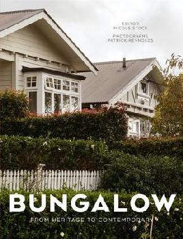
- Griffiths, G. J. How Old Is Our House? A Short Guide to the Documentary Sources and Architectural Records Available in New Zealand Brief 12 page guide which lists useful sources and records for investigating the history of a house.
- Smith, Jo-Anne, How to research the history of a house in Christchurch (also available online) Outlines key principles and considerations for undertaking research.
- Cooke, M. B. The Age of Houses Illustrated A visual reference guide which is useful for identifying the time period in which a house was built based on architectural styles and design features.
Christchurch Street and Place Names index
Was your street always known under its current name? Many streets have changed their names. The Christchurch Street and Place Names index is a good place to look to find any previous names your street was known by. It’s essential to know this as it helps keep your research on track when using essential resources such as directories and historic maps.
Directories
Directories are books that provide organised listings of people, professions and places. Usually they are updated and published every 1-2 years.
Directories, especially historical collections, can reveal a surprising amount of information about the history of a house.
Christchurch City Libraries provides access to two significant historical directory collections:
- Wise's New Zealand Post Office Directory (usually just referred to as Wise's)
- Stone's Canterbury, Nelson, Marlborough & Westland Directory (or Stone’s)
Wise’s and Stone’s are particularly useful for finding out who lived at the property. While both directories give the name of the person who was the “head of the household” (i.e. the person, often a male, who ran the household) Stone’s also includes the names of boarders living at the house. You can also find other details such as their occupations and trace how long they had lived at an address.
Other people living at the address can be found through using Electoral Rolls.
General advice about street directories
When you are using directories to find out who has previously lived in a house it’s useful to note down names of neighbours. This can be helpful for identifying when house numbers have changed.
For example, let's say you are tracking who lived at a house and checking Wise's or Stone's (or both!) year by year. So far you’ve found a Mr Stone living at 123 Everywhere Street and his neighbours include Mrs Lily at number 121, Mr Campbell at 125, and so on. When checking the volume for the preceding year you see that the Mr Stone is no longer listed as living at 123 Everywhere Street but neither do Mrs Lily and Mr Campbell appear. Do these occupants appear anywhere else in Everywhere Street? If so then this may be a clue that the house numbers in the street have been reassigned and so you will need to take this into account.
Street names sometimes change over time so remember to check Christchurch Street and Place Names index to determine if this has happened.
Directories should always be used in conjunction with Electoral Rolls especially if you are trying to establish when and who was living at an address for a given time. The data in any volume of a directory could be a year or two old by the time it got to print. This was due to the amount of time it took to gather, process, and publish the information. Electoral Rolls, because they were updated more often can give a more accurate reflection of when and who was living at the address.
Wise's New Zealand Post Office Directory
Wises is available online through Ancestry Library Edition which provides access to volumes from 1872 to 1955. The same period is available on microfiche at Tuakiri | Identity, Level 2, Tūranga. Later editions of Wise’s are available in print format at Tuakiri | Identity.
Ancestry Library Edition can only be accessed within the library (remote access is not available) through library computers, family history computers or using your own device and connecting to the library’s free wifi service. (Please note that Firefox, Chrome or Safari work better on this resource.)
The most useful section in the Wise’s Directories for learning about a house’s history is the Christchurch Streets Directory.

How to use Wise's directories
It’s useful to be aware of changes in the layout and content of the Wise’s directories over time.
From the 1878-79 volume to the 1904 volume only a selection of Christchurch streets were given their own entry. Streets belonging to Boroughs (and some suburbs) weren’t given their own – instead an entry would be included for the Borough but often this would just list individuals living there.
A comprehensive Christchurch Streets Directory in which the vast majority of streets have their own entry along with the house number and head householder first appears in the 1905 volume. Also, house numbers in urban areas first appeared in the 1885/1886 volume. (Rural, predominately farming districts were not assigned house numbers).
House numbers for addresses continued to appear in each volume right up to the 1979 edition.
How to access Wise’s in Ancestry Library Edition
(Recommended internet browsers for this resource are Firefox, Chrome or Safari)
Select images in the gallery below for a step-by-step guide to finding Christchurch streets.
 Select “Begin Searching”

 Click on the Collections pin for New Zealand

 Choose “New Zealand City and Area Directories 1866-1954” from the list

 Under “Browse this collection” use the drop down menu and choose a year. Select the Directory that is associated with the chosen year.

 This leads you to the digitised volume of Wises for the chosen year. You can “jump” to the beginning of the Christchurch Street index within the volume using the image number field. Use the table later on this page to find the Image Frame Number you need to enter into the box for the relevant year.

Quick Reference Guide for finding the start of the Christchurch Directory section for each volume of Wise’s
| Year/Vol | No. | Year/Vol | No. | Year/Vol | No. |
|---|---|---|---|---|---|
| 1872/1873 | 140 | 1907 | 99 | 1926 | 128 |
| 1875/76 | 82 | 1908 | 104 | 1927 | 129 |
| 1878/79 | 42 | 1909 | 109 | 1928 | 134 |
| 1880/81 | 53 | 1910 | 122 | 1930 | 140 |
| 1883/84 | 75 | 1911 | 123 | 1931 | 136 |
| 1885/86 | 84 | 1912 | 128 | 1933 | 128 |
| 1887/88 | 82 | 1913 | 124 | 1934 | 125 |
| 1890/91 | 88 | 1914 | 111 | 1936 | 130 |
| 1892/93 | 65 | 1915 | 120 | 1938 | 131 |
| 1894/95 | 102 | 1916 | 120 | 1940 | 140 |
| 1896/97 | 103 | 1917 | 122 | 1942 | 550 |
| 1898/99 | 105 | 1918 | 109 | 1943 | 558 |
| 1900 | 110 | 1919 | 421 | 1946 | 631 |
| 1901 | 96 | 1920 | 134 | 1947 | 675 |
| 1902 | 120 | 1921 | 136 | 1950/51 | 583 |
| 1903 | 115 | 1922 | 129 | 1953/54 | 666 |
| 1904 | 94 | 1923 | 125 | 1955 | 701 |
| 1905 | 97 | 1924 | 133 | ||
| 1906 | 114 | 1925 | 129 |
Quick Reference Guide for finding the start of the Lyttelton Directory section for each volume of Wise’s
| Year/Vol | No. | Year/Vol | No. | Year/Vol | No. |
|---|---|---|---|---|---|
| 1872/1873 | 145 | 1907 | 266 | 1926 | 315 |
| 1875/76 | 89 | 1908 | 281 | 1927 | 315 |
| 1878/79 | 116 | 1909 | 295 | 1928 | 322 |
| 1880/81 | 105 | 1910 | 319 | 1930 | 328 |
| 1883/84 | 147 | 1911 | 328 | 1931 | 323 |
| 1885/86 | 158 | 1912 | 325 | 1933 | 310 |
| 1887/88 | 183 | 1913 | 313 | 1934 | 310 |
| 1890/91 | 182 | 1914 | 305 | 1936 | 323 |
| 1892/93 | 47 | 1915 | 306 | 1938 | 329 |
| 1894/95 | 250 | 1916 | 310 | 1940 | 350 |
| 1896/97 | 251 | 1917 | 311 | 1942 | 736 |
| 1898/99 | 269 | 1918 | 289 | 1943 | 746 |
| 1900 | 274 | 1919 | 602 | 1946 | 831 |
| 1901 | 273 | 1920 | 326 | 1947 | 895 |
| 1902 | 311 | 1921 | 331 | 1950/51 | 768 |
| 1903 | 298 | 1922 | 321 | 1953/54 | 857 |
| 1904 | 255 | 1923 | 312 | 1955 | 896 |
| 1905 | 258 | 1924 | 321 | ||
| 1906 | 284 | 1925 | 316 |
Stone's Canterbury, Nelson, Marlborough & Westland Directory

Often referred to as "Stone's", this directory is similar to Wise's in that it too has a Christchurch Streets Index which is useful for determining the age of the house, who lived in the house (head of the household and boarders), and other interesting facts.
Stone’s is available on CD-ROM on library Family History Computers for the period 1904 to 1945.
You can choose any year within this period. The Christchurch Streets Index appears at the beginning of each volume. You can browse the alphabetical list for the street name you are looking for or you can do a keyword search by pressing ctrl+F and entering the street name in the search box.
Print volumes of Stone’s (1946-1955) are available at the ANZC Research Collection at Tuakiri | Identity, Level 2, Tūranga.
Electoral Rolls
Directories help you to search for an address to find out who the head of the household was (usually a male) at that address. Other people living at the address are not included. This is where electoral rolls are useful. Electoral rolls let you to search for a person and see who else with the same surname was living at the same address. Only people who were eligible and registered to vote are included.
The excerpt below is from the Riccarton Electoral Roll of 1919 and we can clearly see four people living at 149 Yaldhurst Road (The Wise’s Directory of 1919 only mentions Edwin Blakeway at 149 Yaldhurst Road).

New Zealand Electoral Rolls from 1853 to 2010 are available on Ancestry Library Edition (Ancestry is only available at the library). From 1984 to the present, New Zealand Electoral Rolls are available in print format at Tuakiri | Identity, Level 2, Tūranga.
How to access New Zealand Electoral Rolls in Ancestry Library Edition
(Recommended internet browsers for this resource are Firefox, Chrome or Safari)
Select images in the gallery below for a step-by-step guide to finding New Zealand electoral rolls in Ancestry.
- Select “Begin Searching”
- Click on the Collections pin for New Zealand
 Choose New Zealand Electoral Rolls 1853-1981 from the list

 Image9The search screen offers keyword searching and browsing

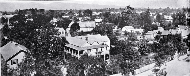
Photographs
Finding a photo of your house is possible but the success rate isn’t very high. You may improve your odds of finding an old image of your house by including street names and suburb names as search terms.
You may also want to use the names of nearby schools, businesses, churches or heritage landmarks in your search. A photo featuring one of these landmarks or institutions may just happen to include your house!
The map collection includes historic Christchurch maps which show the locations of long forgotten public buildings and businesses. A good example is this 1912 map of Christchurch. Some of these buildings may have been in your neighbourhood and so could also be included as search terms.
Here are some image collections and databases for you to start searching:
Digitised images
Try searching the library catalogue. Enter your search terms then narrow your results using the format filter for "Photographs".
The Discovery Wall
The Discovery Wall website contains images, videos and text relating to the city’s unique history and identity, a digital cityscape made up of current and historical images sourced from photo archives spanning Christchurch City Libraries, the Christchurch Star, and submissions from the public including entries in the Christchurch Photo Hunt.
Canterbury Stories

Canterbury Stories is our digital heritage repository. Here you can find images, videos and text relating to the province's history and identity, made up of current and historical images sourced from photo archives spanning Christchurch City Libraries, the Christchurch Star, and submissions from the public including entries in the Christchurch Photo Hunt.
Digital NZ
A useful resource for searching for images. It is an archive of digitised images from libraries, art galleries, museums and other organisations throughout New Zealand. It also offers the ability to restrict results to showing images only, and to a specific decade.
Aerial Photographs
Canterbury Maps allows you to look at historic and recent aerial photographs of Christchurch and surrounding areas. Use this to track how your home and/or the area you live in has changed over time from 1925 to 2019. May be also be useful in figuring out a rough date for when your house was built.
Historical Maps
Historical maps can help uncover interesting details about the area in which your house is situated. For example, some maps of early Christchurch such as this 1954 map include house numbers – this can be helpful when using the Wise's and Stone's Directories for pinpointing the location of the house.

Maps can also be used in association with the Christchurch Street and Place Names index – they may provide a visual representation which leads to a better understanding of how the street has changed.
Papers Past
Papers Past is an archive of New Zealand newspapers from the 19th and early 20th centuries. The major Christchurch newspapers currently available on Papers Past include:
Newspapers may provide a large amount of information about your house and its inhabitants over time.
Some suggestions for searches include:
- House number and street name search – e.g. “1234 Colombo Street” (try variations of the search phrase so that you don’t overlook other useful results e.g. “1234 Colombo St”)
- Search for names of inhabitants you learn have previously lived in the house.
Remember to use the filters such as setting a date search range or narrowing down to a specific region to bring up more relevant results.
CINCH
CINCH (Community Directory of Information database) is an online community directory containing information for around 6,000 community organisations, clubs and continuing education providers in Christchurch.
Use CINCH to find local history groups. Suburb-specific local history groups have members who have in-depth knowledge of the area and are generous in sharing their knowledge.